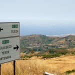
This Canarian village is located in the central west area of the island. The population is under 1500 and a lot of the municipality is covered by mountains. There are also forests, valleys, farmlands and green spaces.
Pinar de Tamadaba, the biggest pine forest in Gran Canaria, is situated about 12 km west of Artenara and this is pretty whether the weather is good or not so good. Tamadaba is even nice when it’s misty and cool because it then has a kind of fairytale quality. Take a jacket or sweater with you when you visit this part of the island. The high altitudes mean it can be up to 15 degrees C cooler than in the resort!
You can enjoy picturesque views of the Caldera de Tejeda on the west coast and also Teide (the mountain on Tenerife) once you come around the Pico de Tamadaba, which is 1444 metres high.
There are several main roads passing through and around Artenara. This is the highest village on Gran Canaria and it is 1270 metres (4167 feet) high. When you enter this old village, you will see a statue of Christ with widespread arms. It is a lot smaller than the one in Rio de Janeiro but similar in style.
A lot of the houses in Artenara are build into the solid rock on the side of the mountain and there are also prehistoric caves. Check out La Ermita de la Cuevita, which is the cave church. You will see the Virgen de la Cuevita (virgin of the cave) inside. On August 15th there is a big fiesta, see our Feast of the Assumption – Asunción de la Virgin post for details.
You can spot the church by looking for the bell above the entrance; that is about the only thing that shows it is a church. There is another church in Artenara called Iglesia de San Matias and this is a more conventional style of church.


